An AI-generated exploration target becomes useful when a geological team can explain what observation should come next. A high ranking can help focus attention, but it cannot establish that mineralisation exists, that an interpretation is unique, or that further expenditure is justified. The immediate task is to turn the target into a geological question that fieldwork can meaningfully test.
Manually gathering, organising, and cross-checking scattered historical reports, maps, and drill records can consume substantial specialist time and incur significant costs. Depending on data quality, AI can assist retrieval, organise records, and flag relationships for review. Reducing repetitive information handling may free specialists to concentrate on geological judgement and validation, while extracted information still requires expert checking.
That starts with the evidence beneath the map. Each important input needs an identifiable source, location, scale and acquisition method. A historical occurrence record, a geophysical response and an interpreted fault may appear together on screen while carrying very different limitations. An old coordinate may be approximate; a mapped contact may have been inferred beneath cover. Combining these inputs does not remove their original uncertainty.
Supporting evidence also needs to be separated from repeated evidence. Several maps derived from the same survey do not provide several independent confirmations. Likewise, nearby samples may share geological conditions and collection biases. A review should ask whether the apparent agreement comes from distinct observations or from different representations of the same information. Missing records should remain visible as gaps, rather than becoming implicit evidence of absence.
Contradictory observations deserve equal attention. A proposed mineral system may fit part of the structural interpretation yet conflict with mapped lithology, alteration, or available geochemistry. Such conflicts should be recorded before they are explained away. They may expose an unsuitable geological model, a positioning error, an unrepresentative sample, or a genuinely unresolved relationship. Their value lies in identifying what remains uncertain, rather than automatically invalidating the target.
The team can then set out competing explanations. In a deliberately hypothetical example, a magnetic feature could reflect a lithological boundary or an intrusive body; its relationship to mineralisation would require further evidence. A specialist should identify plausible interpretations and the observations each predicts. The list will remain incomplete, but making it explicit creates something that colleagues can challenge. A model score alone cannot perform that geological review.
Validation should examine the process as well as its apparent success. Data used to build or tune a model cannot also serve as wholly independent confirmation. Where suitable observations exist, evaluation should account for spatial separation and geological context, rather than relying only on a random split of neighbouring records. New field observations can provide a further check, provided their collection and interpretation are documented and their limitations acknowledged.
The next field test should address a specific disagreement. Depending on exposure and access, that might mean mapping a contact, checking rock properties, or collecting appropriately controlled samples across a predicted change. Before mobilisation, the team should state what result would favour one explanation, weaken another, or leave both unresolved. A negative result is informative only if the test was capable of detecting the feature being sought.
Professional judgement remains central to choosing that test and deciding whether its cost, safety requirements, and practical constraints are acceptable. The outcome may be a revised interpretation, a different survey, a deferred target, or a reasoned decision to stop. The strongest handover from AI analysis is therefore a traceable question, competing explanations and a planned observation that could change the exploration decision.
Captions
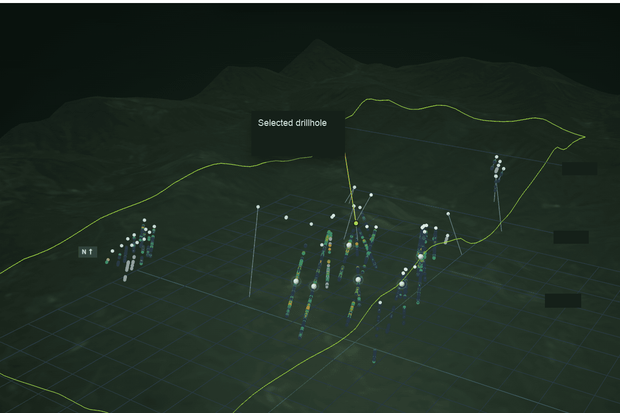
Figure 1 – 3D data visualisation in the StrikOre interface, showing terrain and drillhole traces.
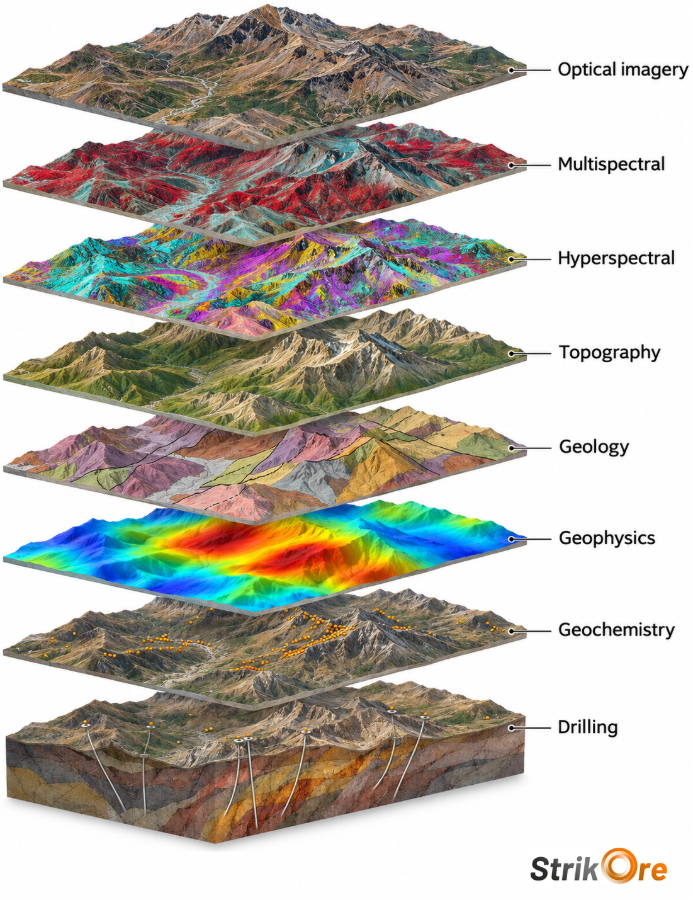
Figure 2 – AI-generated conceptual illustration of eight geoscience evidence types, from optical imagery to drilling.